Kirkby Malzeard & Laverton
History
Welcome!
This website looks into the history of Kirkby Malzeard and Laverton.
The area we focus on is located 6 miles north west of Ripon, 5 miles south of Masham, and nestles under the hills of Dallowgill, whilst Laverton lies a mile to the south of Kirkby. It’s not until you see an aerial photo do you realise how rural the area is.

A s far as the history of the area goes, we have evidence of Stone Age, Bronze Age, as well as Roman presence, including the discovery of a Roman body in 1850.

Detail from a John Speed map, 1610.
‘Chirchebi’ (Church village), as Kirkby was known in the Doomsday Book, later had ‘Malzeard’ (Bad Clearing) added in the 12th century, and there have been several variations of the spelling over the centuries! Technically, Kirkby Malzeard is a ‘town’, as it was granted a market charter by Edward l in 1307, and was an important trading centre.
The earliest evidence of the existing church dates to around 1150, and a Preaching Cross that stands in the churchyard, and the lower part is from the 7th century. There was also a castle built just behind the churchyard.

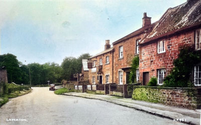
Laverton

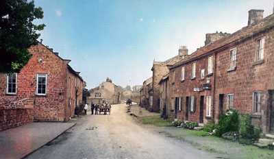
Main Street, Kirkby Malzeard
Although we look into all these subjects, and more, this website is definitely a ‘work in progress’, and we would welcome any feedback, additional information. Please contact us by email: kirkbymalzeardhistory@gmail.com, and have a look at the Facebook group ‘Kirkby Malzeard, Laverton and Dallowgill History’. Last but not least, please visit www.dallowgill.org.uk and www.grewelthorpe.org.uk to find out more on the local area.